ICAO Segelflugkarte Deutschland ohne Folie, Einzelkarte
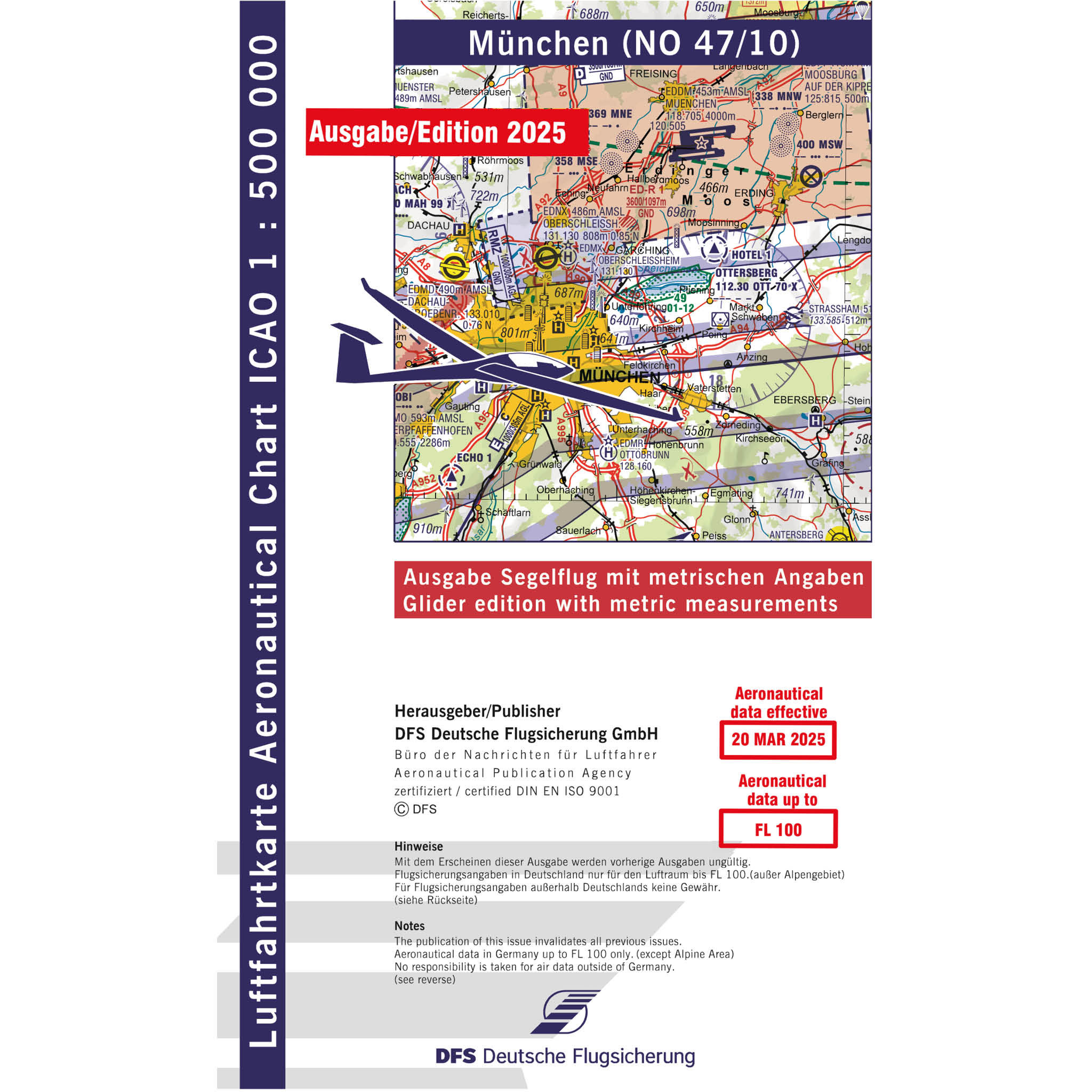

Note from DFS: Please notice changes within the Glider edition of ICAO charts 2025 concerning elevation as follows:
· Terrain heights and obstacles higher than 100 m / 328 ft GND are mentioned in feet.
· Within airspace labeling the altitude is mentioned in feet only.
· The aerodrome elevation is mentioned in feet.
Within gliding sectors the altitude is still mentioned in meters. From 2026 on all datas shall be mentioned in meters again.
The glider edition of the official ICAO chart Germany is especially designed for gliders with specifications in meters. Further on it contains important information about topography and air traffic control like streets, railways, rivers, woods, urbanisation, elevation points, obstacles, airfields, air space and lots more. On the backside you will find a legend, a cutting pattern and helful air space information.
According to the harmonization of European ICAO Charts the colour for the airspace classes C, D, and E has been changed into blue. Further on the identifier MSL (Mean Sea Level) has been omitted, and the identifier GND is replaced by AGL (Above Ground Level).
In total the ICAO charts are seperated in 8 sheets - Hamburg, Rostock, Hannover, Berlin, Frankfurt, Nuremberg, Stuttgart, and Munich.
Format folded: 14,5 x 24cm
Format chart sheet: 83,5 x 61 cm
Scale: 1:500.000
Discount Levels ICAO Charts Germany (paper or laminated): for ordering 20 charts within one order - 10%, for ordering 50 charts within one order - 20%.